The Zambezi
The Zambezi, a river steeped in history, brings life and sustenance to the protected wilderness areas along its banks. At 2,600 km, it is the fourth longest river in Africa. Rising in Zambia, the Zambezi flows through eastern Angola, Namibia, Botswana and then forms the border between Zambia and Zimbabwe before crossing Mozambique to reach the Indian Ocean. The Victoria Falls is the most noted of its waterfalls. Others include the Chavuma Falls and Ngonye Falls, both in Zambia. A large part of Southern Africa relies on the power generated at two of the river's hydroelectric power stations; Kariba Dam and Cahora Bassa Dam.
In 1858, Thomas Baines accompanied David Livingstone on an expedition of the Zambezi River taking them as far as Tete. Baines was tasked with capturing the scenery and discoveries and his paintings became true master pieces. Subsequently, Baines took part in expeditions through other regions of Southern Africa both led by others and by Baines himself. Today the memory of Baines lives on in the numerous illustrations he made on his journeys of the middle and lower sections over the period 1858-1863. His accurate maps, scientific data and illustrations of his travels, the scenery and the people he encountered were published posthumously, The Gold Regions of South-Eastern Africa (1877).
The Lower Zambezi Valley
Although this section of the Zambezi River is officially known as the Middle Zambezi, after the declaration of the Lower Zambezi National Park in 1983, the area starting at the confluence of Zambezi and Kafue Rivers down to where the Luangwa River flows into the Zambezi, is commonly known as the Lower Zambezi Valley. Measuring 4,092 square kilometres, the Lower Zambezi National Park is surrounded by three Game Management Areas: Luano in the North, Rufunsa to the East and the Chiawa GMA to the West. Baines' River Camp is located within the latter. These GMAs together add 14,453 square kilometres of protected wildlife area to the Lower Zambezi National Park, so forming an almost 19,000 km unfenced wilderness where wildlife roams freely. The absence of tar roads, main power supply and strict regulations in terms of preserving this natural resource, tourist numbers are minimal, providing those who make the effort to visit this remote area with a true safari experience.
The Lower Zambezi Valley displays an overwhelming scenic beauty with pockets of different vegetation, ranging from thick bush to palm groves, Albida forests, miombo woodlands and open plains, all set against the backdrop of the Zambezi Escarpment. Although the Valley is not home to “the Big Five”, with over 50 mammal species, visitors will find elephant, buffalo, hippopotamus and a variety of antelope in abundance with regular sightings of Lion, Leopard, Side-striped Jackal, Spotted Hyena, and the endangered African Wild Dog. You will see many of the 370 bird species whilst drifting on the river, including African Skimmers, Carmine Bee-eaters, Ethiopian Snipes and perhaps a rare sighting of the elusive Narina Trogon. The majority of wildlife concentrates on the valley floor around the Zambezi River and its tributaries, which makes for very successful game viewing, both by vehicle and by boat.
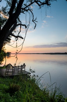
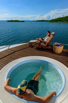
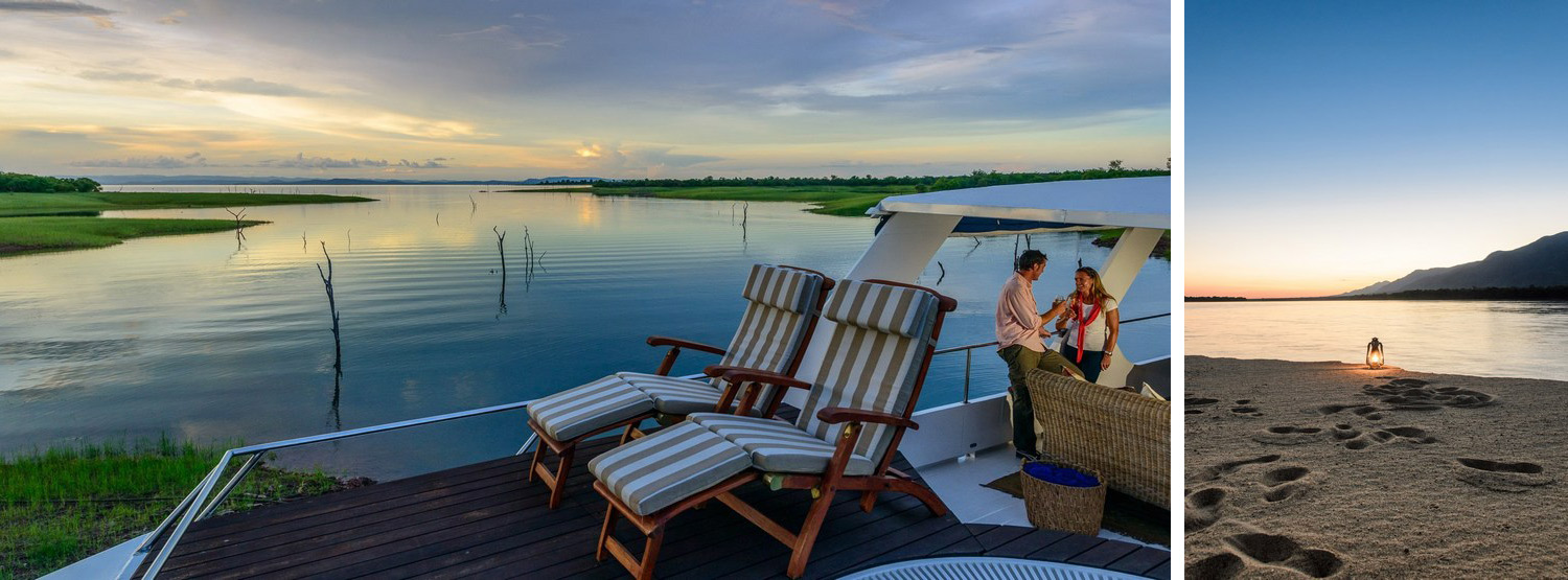
Lake Kariba
The Dam wall that harnesses the Zambezi River at Kariba was built in the 1950s for hydro‐electric power generation and was officially opened in 1959. Operation Noah, a 5‐year wildlife rescue operation, rescued over 6,000 animals, most of which were relocated to the Matusadona National Park whilst the Lake filled up upon completion of the Dam. A large number of families had to be relocated and homed in new towns and villages, now on the shores of the Lake such as Kariba, Binga, Mlibizi and Siavonga. Lake Kariba is not just "big". It is vast, in the true sense of the word. Measuring approximately 220 km from East to West and up to 40 km wide, the lake covers almost 5,600 square kilometres. As a reservoir, Kariba can hold an impressive 180 billion tons of water at any time, making it the largest artificial lake in the world by volume. The filling of the Lake between 1958 and 1963 caused more than 20 earthquakes of greater than 5 magnitude on the Richter Scale. Although constructed for power generation, with an abundance of wildlife on its shorelines, breath taking scenery and its massive surface area to cruise, Lake Kariba soon became a tourist attraction on both the Zambian and Zimbabwean side, frequented by local and international visitors. The shoreline provides many overnight mooring opportunities and offers romantic spots with idyllic waterfalls in places like the Sanyati Gorge. The Matusadona National Park is the centrepiece in this beautiful landscape surrounding the lake and the remnants of the trees in the water provide the signature backdrop to uncountable sunset photographs. This is undoubtedly one of the world's most unique destinations where you will experience tranquillity in its purest form, yet where you will enjoy the most remarkable holiday. Whilst gently traversing the lake, travellers are naturally absorbed by the magnitude and diversity of this wilderness, leaving an everlasting impression and a yearning to one day return.